Total Pageviews

About Me

My photo
Im a pilot at zero four flight school in margate,currently studying for my commercial pilots licence. I really love muscle cars and hope to oneday own a 1967 mustang fastback,its also my dream to get into an international airline as the pilot in command.

10/10/2011


The Boeing 787 Dreamliner is a long-range, mid-size wide-body, twin-engine jet airliner developed by Boeing Commercial Airplanes. It seats 210 to 290 passengers, depending on the variant. Boeing states that it is the company's most fuel-efficient airliner and the world's first major airliner to use composite materials for most of its construction. The 787 consumes 20% less fuel than the similarly-sized Boeing 767. Some of its distinguishing features include a four-panel windshield, noise-reducing chevrons on its engine nacelles, and a smoother nose contour.

The aircraft's initial designation was 7E7, prior to its renaming in January 2005. The first 787 was unveiled in a roll-out ceremony on July 8, 2007, at Boeing's Everett assembly factory, by which time it had become the fastest-selling wide-body airliner in history with 677 orders. By June 2011, 827 Boeing 787s had been ordered by 59 customers, with ILFC having the largest number on order.

The 787 development and production has involved a large-scale collaboration with numerous suppliers around the globe. Final assembly is at the Boeing Everett Factory in Everett, Washington. Aircraft will also be assembled at a new factory in North Charleston, South Carolina. Both sites will deliver 787s to airline customers. Originally planned to enter service in May 2008, the project has suffered from repeated delays and is now more than three years behind schedule. The airliner's maiden flight took place on December 15, 2009, and completed flight testing in mid-2011. Final Federal Aviation Administration and European Aviation Safety Agency certification was received in late August 2011 and the first model was delivered in late September 2011
The 787-8 is designed to seat 234 passengers in a three-class setup, 240 in two-class domestic configuration, and 296 passengers in a high-density economy arrangement. Seat rows can be arranged in four to six abreast in first or business (e.g., 1–2–1, 2–2–2), with eight or nine abreast in economy (e.g., 3–2–3, 2–4–2, 3–3–3). Typical seat room ranges from 46 to 61 in (120 to 150 cm) pitch in first, 36 to 39 in (91 to 99 cm) in business, and 32 to 34 in (81 to 86 cm) in economy.

Cabin interior width is approximately 18 feet (547 cm) at armrest, 1 inch (2.5 cm) over what was originally planned, and 15 in (38 cm) greater than that of the Airbus A330 and A340, while 5 in (13 cm) less than the A350 and 16 in (41 cm) less than the 777.[181] In an industry where economy seats range from 16.3 in (41 cm) to 20.6 in (52 cm) in width; 787 economy seats are 17.18 in (43.55 cm) and 18.5 in (47 cm) wide in nine- and eight-abreast arrangements, respectively. Most airlines are expected to select the 3–3–3 maximum passenger density configuration. Boeing engineers designed the 787 interior to better accommodate persons with mobility, sensory, and cognitive disabilities. For example, a 56-inch (142 cm) by 57-inch (145 cm) convertible lavatory includes a movable center wall that allows two separate lavatories to become one large, wheelchair-accessible facility.

07/10/2011


The Beechcraft 55 / 56 / 58 Baron is a twin-engined four-to-six-seat light touring aircraft with retractable landing gear produced by the US-American manufacturer Beech Aircraft Corporation, today Hawker Beechcraft Corporation.

Crew 1
Passengers max. 5

Propulsion 2 Piston Engines
Engine Model Continental TSIO-520-WB
Engine Power (each) 242 kW 325 hp

Speed 483 km/h 261 kts
300 mph
Service Ceiling 7.620 m 25.000 ft
Range 2.276 km 1.229 NM
1.414 mi.

Empty Weight 1.822 kg 4.017 lbs
max. Takeoff Weight 2.812 kg 6.200 lbs

Wing Span 11,53 m 37,8 ft
Wing Area 18,5 m² 199 ft²
Length 9,09 m 29,8 ft
Height 2,79 m 9,2 ft

First Flight 29.02.1960
Production Status in production
Developed from Beech 95 Travel Air

FAA TCDS 3A16

Data for (Version) Beech 58P Baron
Remarks
The Beech Baron is a development of the Beech 95 Travel Air which itself is a development of the single-engine Beech Bonanza. Beech Baron Models 55 & 56 have total length of 8,53m (27ft 11in). The current production model is the Beechcraft Baron

The PA-32 series began life as the Cherokee Six, a significantly modified six seat development of the PA-28 Cherokee series.


While similar in configuration to the Cherokee, the Cherokee Six differed in a number of major areas. Two of the big differences were implied in its name, a six cylinder O-540 or IO-540 powerplant, and the six seat configuration. While the wing was based on the Cherokee's, the fuselage was substantially larger, with strengthened undercarriage and a larger tail.
Powerplants

PA-32RT-300 Lance II - One 225kW (300hp) Lycoming IO-540-K1G5 fuel injected flat six piston engine driving a two blade c/s propeller.
PA-32R-301 Saratoga SP & II HP - One 225kW (300hp) Textron Lycoming IO-540-K1G5D driving a three blade c/s prop.
PA-32-301T Saratoga II TC - One 225kW (300hp) turbocharged Textron Lycoming TIO-540-AH1A driving a three blade constant speed prop.

Performance

PA-32RT-300 - Max speed 306km/h (165kt), max cruising speed 293km/h (158kt), long range cruising speed 258km/h (139kt). Initial rate of climb 1000ft/min. Service ceiling 14,600ft. Max range with reserves 1600km (865nm).
PA-32R-301 - Max speed 314km/h (170kt), normal cruising speed 302km/h (163kt). Max initial rate of climb 1116ft/min. Service ceiling 15,590ft. Range at normal cruising speed with reserves 1370km (740nm).
PA-32R-301T - Max speed 346km/h (187kt), cruising speed at 10,000ft 324 km/h (175kt), at 15,000ft 343km/h (185kt). Max certificated ceiling 20,000ft. Range at long range cruise power and 10,000ft 1756km (948nm).

Weights

PA-32RT-300 - Empty 912kg (2011lb), max takeoff 1633kg (3600lb).
PA-32R-301 - Empty equipped 1072kg (2364lb), max takeoff 1633kg (3600lb).
PA-32R-301T - Empty equipped 1118kg (2465lb), max takeoff 1633kg (3600lb).

Dimensions

PA-32RT-300 - Wing span 9.99m (32ft 10in), length 8.44m (27ft 9in), height 2.90m (9ft 6in). Wing area 16.2m2 (174.5sq ft).
PA-32R-301T - Wing span 11.02m (36ft 2in), length 8.23m (27ft 0in), height 2.59m (8ft 6in). Wing area 16.6m2 (178.3sq ft).

Capacity

Standard seating for six, some with an optional seventh seat.

Production

By the end of 2004, 7842 PA-32s of all versions have been built, including 4420 PA-32s and 3422 PA-32Rs.

Description:
The Cessna 208B Caravan is manufactured by the Cessna Aircraft Company in Wichita, Kansas, USA. Incorporated in 1911, the Cessna Aircraft Company has a legacy of aircraft production spanning almost a century. At the end of 1995 Cessna had produced a total of 178,394 aircraft.

The Caravan was designed at the outset to be simple, rugged and reliable. The first prototype Caravan flew in 1982. Full production commenced in 1985. The principle user of the Caravan is Federal Express, who utilise the aircraft for overnight parcel delivery. In this application the aircraft is operated at night and frequently in poor weather. It's incredible 99.8% dispatch rate is a testament to the success of the design. In 1986, at the request of Federal Express, a stretched version of the Cessna Caravan, the Cessna Grand Caravan was put into production.

For Wilderness Air, the Caravan has proven to be the best passenger carrying bush aircraft in our fleet for sectors of from 20 to 300 km. Though it is still comfortable and is on occasion used on sectors up to 1000km. The aircraft is capable of taking off from nearly all bush airstrips we service. This is made possible by its large wheels, a very efficient wing and powerful engine. Its wide spacious air conditioned cabin, large windows and unrestricted view, made possible by a high wing make the Caravan very popular with all our passengers. The 4-door cargo pod located under the fuselage also gives the aircraft a very generous luggage carrying capacity.

Specifications:
ENGINE TYPE:
Single engine turbine


PRESSURISED CABIN:
No

CRUISING ALTITUDE:
12 000ft

DEMURRAGE:
650km/day

PAX:
12 passenger seats - maximum

SPEED:
260km/h

CREW:
1

PERFORMANCE:
The Caravan is not pressurised. It therefore operates at a maximum altitude of 12,000ft when carrying passengers. Typically on a 30 minute sector the plane will be flown at 6,500ft.

03/10/2011

Bedrooms
3
Master bedroom with spectacular sea views.

Bathrooms
2
Main en suite.

Lounge
1
Open plan, with access onto covered patio.

Dining room
1
Open plan.

Bar
1
Fitted.

Kitchen
1
Well appointed and modern.

Balcony
1
Covered, sea views.

Pool
1
Within private garden.

Sunroom
1
Exceptionally spacious off pool.

Garage
3
Double with extra height clearance, separate single.

Workshop
1


Description: This exceptional home has an elevated view of the Indian

Ocean, whilst being right on the surf's edge and at the mouth of a pristine

river estuary.

The cluster development of "Le Shac" comprises 42 very up-market units

that seldom come on the market and get snapped up due to the ideal location,

exclusivity of the immaculate secure complex and the proximity to

the powdery sands and surf.

The entire complex is kept to the same exacting standards as this unit.

Internal roads of the complex are neatly paved and the perimeter is

secure with remote access gate, walls and electric strands.

A couple of features of the complex include direct beach access and a

communal clubhouse where owners gather for a casual social life.

Stroll through the photo spread below to appreciate the truly breathtaking

views of a long stretch of unspoilt sands while being a mere 2km from the

business hub of the South Coast, the Shelly Centre and the new South Coast Mall.

As can be seen in the photo gallery this unit is a duplex with the entire living

quarters on the upper level, with the pool on the elevated landscaped rear

section.

The lower level of the unit comprises entrance hall, double garage, workshop

and single garage. These garages have direct access into the unit.

Another feature of the double garages are the remote doors with extra height

clearance. This is ideal for a caravan or microbus.

On the way up to the living level the entrance hall plays host to a storage area,

which would be ideal as a wine cellar.

The open plan living rooms of lounge, dining room, bar and well appointed kitchen

all lead out on the ocean side of the unit to a deep all weather covered balcony.

The sea views from this vantage point are spectacular.

In addition, the living rooms have the same large sliding glass doors that lead out onto

the private pool and enclosed garden on the west side.

An absolute bonus is the large sun room alongside the pool. This sun room is spacious

enough to hold a decent sized party, or be set up as a games and rumpus room.

Sleeping quarters comprise 3 bedrooms and two bathrooms, the main bathroom

being en suite.

The master bedroom enjoys the same sea views as the living rooms, and has sliding

door access onto the deep all weather covered patio.

Being a freehold unit this property comes without the usual restrictions placed on

owners by body corporate management. A minimal levy of R280.00 per month is

payable for the general upkeep of the complex.

Aimed at the discerning buyer this up-market complex is situated in the fastest

growing suburb on the South Coast, whilst still offering a short stroll onto the

powdery sands on a long sweep of beach.

Absolutely irresistible !!!!!


Le Shac

Number 21

Shelly Beach.

PRICE: R2,850,000.
OWNERS: Alwin & Brenda Hohls

Tel: (039) 315 5775

Cel: 083 293 4788

Cel: 083 309 3344

e mail: abhohls@mweb.co.za


01/09/2011

Hi everyone

please comment on this post about what you would like to see on this blogpage like more pictures,videos,stories etc

22/08/2011

The Ipad is the pilots best friend

ipadpilotDelta Airlines has deployed 22 iPads into its global pilot workforce, as a preliminary trial of the iPad's ability to act as an electronic flight bag. They're not the first to do so, with American Airlines bagging that title after they gained FAA approval back in 2010, but Delta's move points to a growing trend among fliers--if your job or pastime involves gliding through the air, then the iPad is about to revolutionize the experience.
For Delta, the iPads act as a lighter, more efficient and more up-to-date version of the little leather trolley case pilots usually have to haul around with pounds of flight plans, weather charts, and other paperwork they need to fly airliners. It's part of a bigger digital overhaul for Delta, which has integrated Gogo's in-flight Wi-Fi to its domestic fleet, enabling pilots to get up-to-date information and even company emails as they fly... and Delta's also experimented with loaning iPads as entertainment units to customers.
All Delta's pilot's tablets have the same core software, which contain charting apps, company flight manuals in PDF format, a custom meteorology app from Delta which includes the company's own real-time radar data, an app for writing notes, and crew rest calculators for longer flights. The company can also push real-time security updates to all its iPad crew in-flight, and even direct them into new re-routes as they fly.
But while Delta is going down the custom app route, the huge suite of apps for pilots in the App Store proves that it's a massive industry. ForeFlight Mobile HD is a good example, claiming to be the "perfect pilot-companion: in-flight or on the ground," it's typical of the more full-featured apps. In addition to offering flight planning that's infinitely easier than is usually required--it integrates routing information and weather into a single display that you simply have to touch ("drag your route line around weather")--it also incorporates downloadable packages that report airport procedures and maps, it also lets you check fuel prices, airspace restrictions, and weather forcasts are presented as interactive maps before you fly. Because it's a real-time service, it's actually a subscription app--and there's a more expensive Pro edition that actually tracks you in-flight, keeping "tabs on groundspeed, tract and geometric altitude" all with the "standard pinch to zoom and panning gestures."
Back in July 2010, Plane And Pilot Mag profiled 20 apps that were useful for pilots, ranging from the free and simple AeroWeather to Jeppesen, a professional grade app that details the approach procedures for airports around the globe, and one that Delta is using as part of its trial.
Everything from pre-flight planning to in-fight emergency weather updates can be delivered via the iPad--and if there's an emergency, the manuals are all electronic and searchable, potentially saving vaulable time instead of having pilots flick through a paper copy.
Proof positive that the iPad's innovation is also changing the entire flight industry comes from British Airways: It's trialing them as dynamic, real-time data tools for senior flight crew--helping them move passengers to connecting flights and replacing the paper-based manifests that have been law since commercial flying began.
Bonus: American Airlines, during its iPad trial program, suggested that by ditching the heavy paper-based pilot flight bags for iPads, they'd save enough weight to reduce their annual fuel bill by $1.2 million. Which also means less polluting fuel is burned.

16/08/2011

VOR tracking beacons

VORs are assigned radio channels between 108.0 MHz (megahertz) and 117.95 MHz (with 50 kHz spacing); this is in the VHF (very high frequency) range. The first 4 MHz is shared with the ILS band (See Instrument landing system). To leave channels for ILS, in the range 108.0 to 111.95MHz, the 100 kHz digit is always even, so 108.00, 108.05, 108.20, and so on are VOR frequencies but 108.10, 108.15, 108.30, and so on, are reserved for ILS.
The VOR encodes azimuth (direction from the station) as the phase relationship of a reference and a variable signal. The omni-directional signal contains a modulated continuous wave (MCW) 7 wpm Morse code station identifier, and usually contains an amplitude modulated (AM) voice channel. The conventional 30 Hz reference signal is on a 9960 Hz frequency modulated (FM) subcarrier. The variable amplitude modulated (AM) signal is conventionally derived from the lighthouse-like rotation of a directional antenna array 30 times per second. Although older antennas were mechanically rotated, current installations scan electronically to achieve an equivalent result with no moving parts. When the signal is received in the aircraft, the two 30 Hz signals are detected and then compared to determine the phase angle between them. The phase angle by which the AM signal lags the FM subcarrier signal is equal to the direction from the station to the aircraft, in degrees from local magnetic north, and is called the "radial."
This information is then fed to one of four common types of indicators:
  1. An Omni-Bearing Indicator (OBI) is the typical light-airplane VOR indicator[3] and is shown in the accompanying illustration. It consists of a knob to rotate an "Omni Bearing Selector" (OBS), and the OBS scale around the outside of the instrument, used to set the desired course. A "course deviation indicator" (CDI) is centered when the aircraft is on the selected course, or gives left/right steering commands to return to the course. An "ambiguity" (TO-FROM) indicator shows whether following the selected course would take the aircraft to, or away from the station.
  2. A Horizontal Situation Indicator (HSI) is considerably more expensive and complex than a standard VOR indicator, but combines heading information with the navigation display in a much more user-friendly format, approximating a simplified moving map.
  3. A Radio Magnetic Indicator (RMI), developed previous to the HSI, features a course arrow superimposed on a rotating card which shows the aircraft's current heading at the top of the dial. The "tail" of the course arrow points at the current radial from the station, and the "head" of the arrow points at the reciprocal (180 degrees different) course to the station.
  4. An Area Navigation (RNAV) system is an onboard computer, with display, and up-to-date navigation database. At least two VOR stations, or one VOR/DME station is required, for the computer to plot aircraft position on a moving map, or display course deviation relative to a waypoint (virtual VOR station).
D-VORTAC TGO (TANGO) Germany
In many cases, VOR stations have co-located DME (Distance Measuring Equipment) or military TACAN (TACtical Air Navigation) — the latter includes both the DME distance feature and a separate TACAN azimuth feature that provides military pilots data similar to the civilian VOR. A co-located VOR and TACAN beacon is called a VORTAC. A VOR co-located only with DME is called a VOR-DME. A VOR radial with a DME distance allows a one-station position fix. Both VOR-DMEs and TACANs share the same DME system.
VORTACs and VOR-DMEs use a standardized scheme of VOR frequency to TACAN/DME channel pairing so that a specific VOR frequency is always paired with a specific co-located TACAN or DME channel. On civilian equipment, the VHF frequency is tuned and the appropriate TACAN/DME channel is automatically selected.

Seaweed as jet fuel

For airlines, the solution to soaring fuel prices might be as simple as seaweed.
Virgin Atlantic, Air New Zealand, and Boeing are working together to create the world’s first green aviation fuel made from pond-grown algae.
Higher fuel prices and growing concerns over environmental damage caused by conventional aviation fuel are driving plans to produce biofuels based on algae.
Virgin’s Sir Richard Branson says that the concept has “huge potential,” adding, that it’s a source of energy that “doesn’t lead to deforestation or take away land or water from the cultivation of essential food crops.”
Why algae? Scientists say it can grow incredibly fast – doubling in size in a few hours – and it does not need fresh water or good quality land.
Thick green algae produces at least 15 times more oil per hectare than alternatives such as palm oil, soya or jatropha, a nut-bearing shrub cultivated in several countries as a biofuel.
Separately, Continental Airlines, Boeing, and GE Aviation is hoping to flight test a type of biofuel in 2009. Green Car Congress reported in March that green fuels are ready for takeoff.
The Continental Airlines biofuel flight will use a Boeing Next-Generation 737 equipped with CFM International CFM56-7B engines, using a blend of between 20%-50% of a second-generation biofuel in one engine.
Although they have yet to select the type of biofuel to use, the partners say that it will be a second-generation fuel that does not impact food production. It will also be able to be produced in sufficient quantities to support a pre-flight test schedule that includes laboratory and ground-based jet engine performance testing to ensure compliance with stringent aviation fuel performance and safety requirements.
In February 2008, Virgin Atlantic, Boeing, GE Aviation, and Imperium Renewables successfully flight-tested a Boeing 747 equipped with GE engines using a 20 percent blend of a biojet fuel—a transesterified bio-kerosene — derived from babassu and coconut oil in one engine.
This sounds good. But with fuel prices likely to fall now that Saudi Arabia has decided to increase oil production, will these alternative fuel initiatives endure?
Only time will tell.

Two missing planes

Five helicopters, including an SA Air Force Oryx, which was dispatched from the Hoedspruit Airforce Base, lifted off at about 40 minute intervals throughout the afternoon, searching in vain in mountainous terrain.
By 5pm yesterday, the search was called off.
"They are currently rerouting the helicopters to the centre and there has been no indication of a crash site yet,"Greater Mopani District Municipality spokesperson Mashadi Mathosa said.
At about 4.30pm, the Oryx left with a team of four search and rescue members on board, taking another stab at finding the two Albatros aeroplanes.
On its return, rescue team members, of whom many had to sleep in the veld overnight on Sunday, were fed dinner and coffee.
They were debriefed and had the night to rest, before regrouping to start the search at 6.30am.
Yesterday's search and rescue efforts continued in an atmosphere of tense efficiency, as every bit of information coming in to the centre was plotted on a map, and coordinates of any possible sighting sent to a helicopter.
The helicopter then swooped down to pick up a team of four rescuers, and headed out to the search areas, where the teams were dropped to search on foot.
The search included more than 100 members from various organisations such as the Limpopo Emergency Services, the SAAF, police, the Off Road Rescue and Mountain Rescue units and private pilots. It stretched over an area of between 180km² and 210km² in mountainous and vegetated terrain between Maake and George's Valley in the Wolkberge.
Low cloud cover and heavy fog limited visibility to about 10m, and caused the helicopters to be ineffective as search platforms, and could only be used to ferry search teams.
Aviation authorities lost contact with the two Albatros aircraft, confirmed to be carrying 13 passengers, at around 3pm on Sunday.
The planes were returning to Rand Airport from an airshow organised at the Tarentaal airstrip, about 15km outside Tzaneen.

13/08/2011

Tire blowout!!!

Yesterday i was sitting in the office when i recieved a call from Neil one of the instructors here at Zero four, He said he had a burst tire on landing when he landed at port st Johns airfield which is around  an hours flying time away. Upon further disscussion on the matter it was decided that i would fly to Port st Johns with a spare tire, an engineer and a saftey pilot because of the intense wind. We arrived at the airfield and i set up an approach for landing, just before the start of the runway the wind gusted and pushed the plane sideways so i aborted landing and did a go around. On the second try i managed to get the plane alot straighter than before although the plane was still very skew, just before the start of the runway the wind changed direction and was now behind me, it pushed the plane forwards and gained a substantial amount of speed. I put the plane down as fast as I could and tried to slow the plane down before the end of the runway, on the other side of which was a 500m drop off a cliff.

I managerd to slow the plane down in time and we unloaded the spare tire and got the other plane going again, so it was an eventful day had by all but Port st Johns still remains a very tricky and dangerous runway when it comes to windy days.

05/08/2011

One of the extraordinary sights associated with this supersonic transition is the production of a sudden visible vapor cloud around the aircraft. The report of the photographers is that they snap the shutter when they hear the sonic boom, which certainly associates the cloud with the breaking of the sound barrier. But the photo of the B-2 below, which is slightly subsonic, blurs that distinction. It seems safe to say that the phenomenon is associated with the extraordinary conditions very near the speed of sound. Mark Cramer describes this condensation effect in terms of the Prandtl-Glauert Singularity. In this phenomenon, the non-linear or "chaotic" effects amplify all pressure perturbations, leading to some regions of anomalously high and low pressure. If the associated volumes cannot quickly change, then the ideal gas law suggests that the temperature in the low pressure regions must drop, leading to condensation of the water vapor present. This general description probably applies, even though in the presence of condensation, the gases are not exactly "ideal".
The photo credit is Photographer's Mate Airman Chris M. Valdez, Navy NewsStand -- Eye on the Fleet Photo Gallery ( http://www.news.navy.mil/view_photos.asp, 040129-N-0905V-024).
F14-B Tomcat Fighter Jet, United States Navy, Mediterranean Sea, April 22, 2003
Load video of F-14
Photo credit:Photographer's Mate Airman Justin S. Osborne, Navy NewsStand -- Eye on the Fleet Photo Gallery ( http://www.news.navy.mil/view_photos.asp, 030422-N-0382O-588).
F/A-18 Hornet Fighter Jet, United States Navy, off the coast of Pusan, Taehan-min'guk - Republic of Korea, July 7, 1999
Photo credit: Ensign John Gay, Navy NewsStand -- Eye on the Fleet Photo Gallery ( http://www.news.navy.mil/view_photos.asp, 990707-N-6483G-001).
This photo of the B-2 Spirit Stealth Bomber, which does not break the sound barrier, shows that the extraordinary cloud effect is not exactly tied to the breaking of the sound barrier. The aircraft was completing a mission over the Pacific Ocean.
This photo is credited to Bobbi Garcia, a civilian aerial photographer working for Rohmann Services in support of the Air Force Flight Test Center (AFFTC). It appeared in the December 30, 2002 issue of Aviation Week and Space Technology.
General references for the top three photos and many others: United States Navy (USN, http://www.navy.mil ), United States Department of Defense (DoD, http://www.DefenseLink.mil or http://www.dod.gov), Government of the United States of America (USA).

Sound barrier

Air Navigation and the point of no return

The first step in navigation is deciding where one wishes to go. A private pilot planning a flight under VFR will usually use an aeronautical chart of the area which is published specifically for the use of pilots. This map will depict controlled airspace, radio navigation aids and airfields prominently, as well as hazards to flying such as mountains, tall radio masts, etc. It also includes sufficient ground detail - towns, roads, wooded areas - to aid visual navigation. In the UK, the CAA publishes a series of maps covering the whole of the UK at various scales, updated annually. The information is also updated in the notices to airmen, or NOTAMs.
The pilot will choose a route, taking care to avoid controlled airspace that is not permitted for the flight, restricted areas, danger areas and so on. The chosen route is plotted on the map, and the lines drawn are called the track. The aim of all subsequent navigation is to follow the chosen track as accurately as possible. Occasionally, the pilot may elect on one leg to follow a clearly visible feature on the ground such as a railway track, river, highway, or coast.
Adjustment of an aircraft's heading to compensate for wind flow perpendicular to the ground track
When an aircraft is in flight, it is moving relative to the body of air through which it is flying; therefore maintaining an accurate ground track is not as easy as it might appear, unless there is no wind at all — a very rare occurrence. The pilot must adjust heading to compensate for the wind, in order to follow the ground track. Initially the pilot will calculate headings to fly for each leg of the trip prior to departure, using the forecast wind directions and speeds supplied by the meteorological authorities for the purpose. These figures are generally accurate and updated several times per day, but the unpredictable nature of the weather means that the pilot must be prepared to make further adjustments in flight. A general aviation (GA) pilot will often make use of either the 
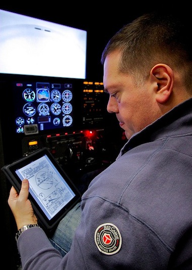
E6B flight computer - a type of slide rule - or a purpose-designed electronic navigational computer to calculate initial headings.
The primary instrument of navigation is the magnetic compass. The needle or card aligns itself to magnetic north, which does not coincide with true north, so the pilot must also allow for this, called the magnetic variation (or declination). The variation that applies locally is also shown on the flight map. Once the pilot has calculated the actual headings required, the next step is to calculate the flight times for each leg. This is necessary to perform accurate dead reckoning. The pilot also needs to take into account the slower initial airspeed during climb to calculate the time to top of climb. It is also helpful to calculate the top of descent, or the point at which the pilot would plan to commence the descent for landing.
The flight time will depend on both the desired cruising speed of the aircraft, and the wind - a tailwind will shorten flight times, a headwind will increase them. The E6B has scales to help pilots compute these easily.
The point of no return, sometimes referred to as the PNR, is the point on a flight at which a plane has just enough fuel, plus any mandatory reserve, to return to the airfield from which it departed. Beyond this point that option is closed, and the plane must proceed to some other destination. Alternatively, with respect to a large region without airfields, e.g. an ocean, it can mean the point before which it is closer to turn around and after which it is closer to continue. Similarly, the Equal time point, referred to as the ETP (also Critical point(CP)), is the point in the flight where it would take the same time to continue flying straight, or track back to the departure aerodrome. the ETP is not dependant on fuel, but wind, giving a change in ground speed out from, and back to the departure aerodrome. In Nil wind conditions, the ETP is located halfway between the two aerodromes, but in reality it is shifted depending on the windspeed and direction.
The aircraft that is flying across the Ocean for example, would be required to calculate ETPs for one engine inoperative, depressurization, and a normal ETP; all of which could actually be different points along the route. For example, in one engine inoperative and depressurization situations the aircraft would be forced to lower operational altitudes, which would affect its fuel consumption, cruise speed and ground speed. Each situation therefore would have a different ETP.
Commercial aircraft are not allowed to operate along a route that is out of range of a suitable place to land if an emergency such as an engine failure occurs. The ETP calculations serve as a planning strategy, so flight crews always have an 'out' in an emergency event, allowing a safe diversion to their chosen alternate.
The final stage is to note which areas the route will pass through or over, and to make a note of all of the things to be done - which ATC units to contact, the appropriate frequencies, visual reporting points, and so on. It is also important to note which pressure setting regions will be entered, so that the pilot can ask for the QNH (air pressure) of those regions. Finally, the pilot should have in mind some alternative plans in case the route cannot be flown for some reason - unexpected weather conditions being the most common. At times the pilot may be required to file a flight plan for an alternate destination and to carry adequate fuel for this. The more work a pilot can do on the ground prior to departure, the easier it will be in the air.

04/08/2011

Piper Sartatoga PA32-R

The Piper PA-32R is a six-seat, high-performance, single engine, all-metal fixed-wing aircraft produced by Piper Aircraft. The design began life as the Piper Lance, a retractable gear version of the Piper Cherokee Six. Later models are known as Saratogas. The primary difference between the Lance and early Saratoga is the development of a tapered wing on the Saratoga replacing the "hershey bar" wing on the Lance that was a carryover from the Cherokee Six. Later Saratoga models provided updated/improved avionics, engine and interior touches but retained the same airframe design.
The Lockheed C-130 Hercules is a four-engine turboprop military transport aircraft designed and built originally by Lockheed, now Lockheed Martin. Capable of using unprepared runways for takeoffs and landings, the C-130 was originally designed as a troop, medical evacuation, and cargo transport aircraft. The versatile airframe has found uses in a variety of other roles, including as a gunship (AC-130), for airborne assault, search and rescue, scientific research support, weather reconnaissance, aerial refueling, maritime patrol and aerial firefighting. It is the main tactical airlifter for many military forces worldwide. Over 40 models and variants of the Hercules serve with more than 60 nations.
During its years of service, the Hercules family has participated in countless military, civilian and humanitarian aid operations. The family has the longest continuous production run of any military aircraft in history. In 2007, the C-130 became the fifth aircraft—after the English Electric Canberra, B-52 Stratofortress, Tupolev Tu-95, and KC-135 Stratotanker—to mark 50 years of continuous use with its original primary customer, in this case, the United States Air Force. The C-130 is also the only military aircraft to remain in continuous production for 50 years with its original customer, as the updated C-130J Super Hercules


Conversions

It took me 3.2 hours to convert onto the Saratoga and now i have a conversion to fly a very powerfull plane:) todays landings were excellent and i enjoyed every second of it because we did full load circuits and the plane performed exceptionally well.

02/08/2011

Saratoga

Yesterday was the start of my first variable pitch propellor experience, going from a 180 horsepower engine to a 300 horsepower engine was a dream. The plane was so smooth in the handling and the landings were incredibly easy, the Saratoga is an amazing machine and i cant wait to fly it again today!

28/07/2011

c130 Hercules

Yesterday the other team playing war games against the team here at margate launched a surprise attack, in the morning a hawk fighter flew over and simulated dropping 2 bombs on the airport. after the excitement over the radio came a call that a Hercules c130 plane was going to land, the airport went crazy every one was grabbing cameras and video recorders just to see this magnificent aircraft land here. It landed and stopped within a shorter distance than all the planes here which was incredible considering its size, I have some amazing photos that im going to put up a bit later so keep checking facebook and twitter for the links ill also post some videos of it for you to see:)

26/07/2011

Big Fails!


Wind, Rain and cold weather

Its pouring down here at margate airport, the weather charts predict around 8.4mm of rain every 3 hours. Rain causes major visibilty issues as it makes final approach seem higher than it really is, so when you do realise your to high you end up nose diving the plane to lose height which ofcourse increases your approach speed and the tendency of the aircraft to aquaplane. Aquaplanning occurs on wet runways where the approach speed is to high and on touch down the wheels lock and start to skid acroos the wet surface which if left uncorrected can cause the plane to skid completely off the runway without the being able to use the brakes.

22/07/2011

Rv-6 and Rv-6 in inverted flight


Rv-6

Want to do my conversion onto an Rv-6! its a small little 180 horsepower piston engine aircraft that is perfect for aerobatic manoevres, I want to do my conversion and then save up some money to go learn how to do some really insane moves in the air that would make most people bring up their breakfast.

21/07/2011

The Spin

When the aircraft enters a spin it is in a stalled flight condition where the aircraft follows a vertical spiralling descent path. The aircraft is stalled but at the same time rolling and yawing and one wing generating more lift than the other. The aircraft is autorotating as long as it is kept in the spin, some aircraft are able to fly themselves out of a spin by just letting go of the flight controls.
Entering a spin deliberately is easy: bring the aircraft in the stall and introduce a yawing motion by applying rudder, left or right. The wing will drop and the aircraft enters a spin and moves about all three axes: rolling, yawing, pitching and uncoordinated thereby losing altitude at low airspeed.

When fully set in a spin, the aircraft spirals downwards at a high rate of descend about the vertical axes and with the wings at a large angle of attack. Some upward force is generated opposite to the weight of the aircraft, slowing its descent. The outer rapidly moving wing has lower AOA and more lift, adding to the rolling motion, contrary to the inner wing with a higher AOA and more drag and this condition helps the aircraft yawing.

Autorotation

This is when the spin starts. The aircraft must be at or beyond the point of stall, and with a difference in AOA between the wings the autorotation starts.
Autorotation is fed by roll and yaw. Roll is caused by the outer wing with lower AOA and more lift and the inner wing has less lift with a higher AOA. Yaw is caused by the inner wing generating more drag.

Normal flight

When a wing drops in normal flight the AOA increases and the wing generates more lift so that there is a natural tendency to roll back and the aircraft stabilizes by itself.

Stalled flight

When a wing drops in stalled flight the increase in AOA causes the wing to be more deeply stalled resulting in less lift and the drop will continue. At this point the drag (CD) will increase leading into a yaw in the direction of the lower wing. This yaw leads to more roll and autorotation has started.
For autorotation to occur we need only one stalled wing.

Characteristics

Every aircraft has its own spin characteristics, but most will go through an early incipient spin where rate of roll and yaw are fluctuating and the pilot may feel some airframe buffeting. If action is taken at this point the recovery will be almost instantly.
After these initial one or two turns into the spin it will become more developed, wings will be deeply stalled and the attitude will be flatter. Recovery will take more time and probably a turn or two.
Different CG positions will have their effect on stall/spin behaviour. A rearward CG will result in a flatter spin and difficulty with recovery. A forward CG makes spin entry a bit more difficult and the nose will be lower during spin. Recovery is much easier. Which emphasizes the fact that no aircraft should be flown with the CG outside of the limits.

Spin recovery

Normally demonstrated by a qualified flight instructor during flight training (during aerobatics or aircraft familiarization). The exact procedure for a full recovery depends on the type of aircraft. But the standard, generalised procedure is as follows:
  • Close throttle and flaps up, on some aircraft types flaps may not even be used on spin training
  • Apply full opposite rudder to stop the spin rotation
  • Hold until rotation stops, this can take a second or a turn or two
  • Reduce the AOA by easing the yoke or stick forward
  • The moment the spin stops, centralize rudder, level the wings and pull gently out of the dive
Again, the spin is a stalled condition of the aircraft. Unintentional spins can be avoided by not allowing the aircraft to stall (take immediate action to recover) and by avoiding uncoordinated flight which leads to autorotation when flying close to the stalling AOA.

20/07/2011

Pc7

We just got invited to sit in the pc7 it was so incredible!! Its a full glass cockpit with every instrument you can imagine. They even have ejection sets and can be fitted to carry weapons, unfortunately we cant go up for a flight because the last person who went up accidentally pulled the ejector seat.

Inside the A380